This article has also been cross-posted at Greater Auckland and you can comment there.
When you talk about cities and transport, one term that comes up almost immediately is density. It’s a simple idea - how many or few people are in a given place. But it’s notoriously difficult to define, not because it’s hard to measure, but because there are so many possible ways of doing it.
It’s equally hard to visualise or intuitively understand what a given density figure means. What does 2200 people per square kilometre feel like? How does one city compare to another? And so on.
So to give you a feel for what density means in practice, let’s take a look a city you’re probably familiar with if you’re reading this blog, and play with it. Doing some alternative history, what would Auckland look like if it had developed in a denser pattern, or a sparser one? How big or small would it be?
Definitions
First of all, let’s get some numbers. We’re going to look at Auckland as it was in 20131. In order to come up with a figure for how dense it is, I’ve decided to go with the OECD’s definition: contiguous areas with more than 5,000 people at a density of more than 300 people per square kilometre2. I’ll also use this for other New Zealand cities. For the international cities, I’ve gone with the figures on their Wikipedia pages3.
Auckland as it is today
Doing a little GIS magic, we can come up with a figure for Auckland. By this standard, the main urban area of Auckland held 1,282,270 people in an area of 582.2 square kilometres, an average of 2,202 people per square kilometre.

You’ll notice a few things. Some large industrial areas (Penrose, Manukau, East Tamaki) aren’t included. This is because no-one lives there. Internationally, industrial areas are largely the same everywhere. In sparser cities, they’re peppered throughout the metropolitan area. In denser cities, they tend to be on the outskirts or outside the city completely. Either way, they’re not really relevant to the density that matters to most people.
This makes Auckland by far the densest city in New Zealand, and about the same density as Melbourne. Within Auckland, some areas are more or less dense than this, but the most median areas, the most typical, are:
- South Auckland (the former Manukau City Council area) taken as a whole.
- Hillsborough
- Narrow Neck
- Saint Heliers
- Western Springs
1,800
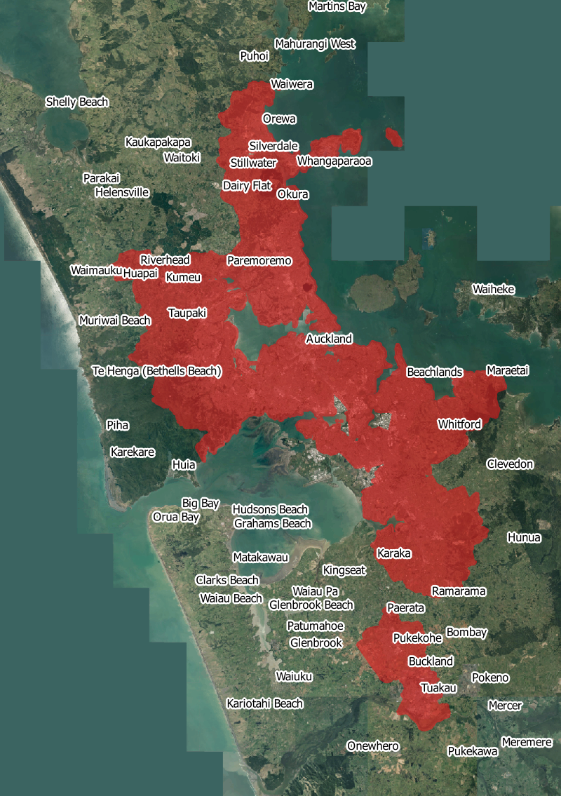
Now let’s see what happens if we make the city a little sparser (less dense). Going down from 2,200 people per square kilometre to 1,800, we get this:
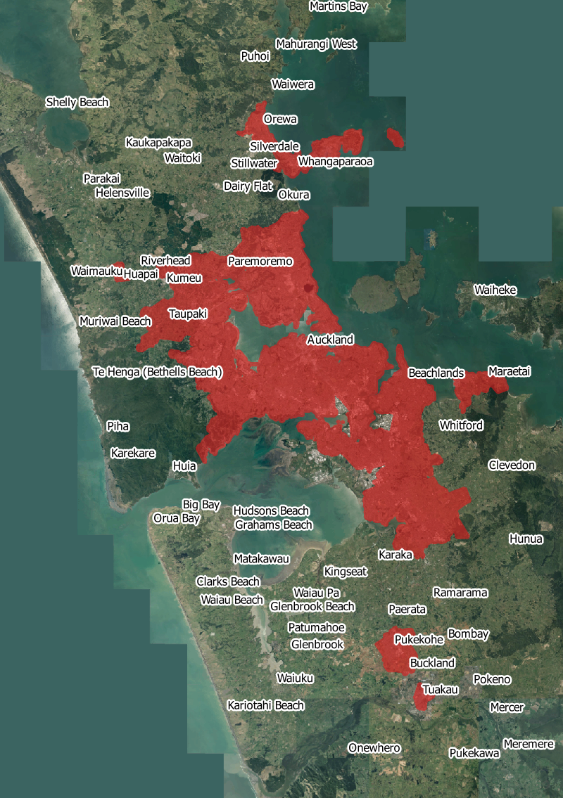
If Auckland were less dense, but had the same number of people, it would of course be bigger4. In this case, it would spread to about Kumeu in the west, and Ardmore in the southeast. This is also about the density you’d find in:
- Brisbane, Australia
- Hamilton
- Hastings
- Wellington
Within Auckland, the areas that are about this density already are
- The North Shore, taken as a whole (the former North Shore City Council, plus the built up areas of Orewa, Silverdale, and Whangaparaoa)
- Green Bay
- Mangere Bridge
- Orakei
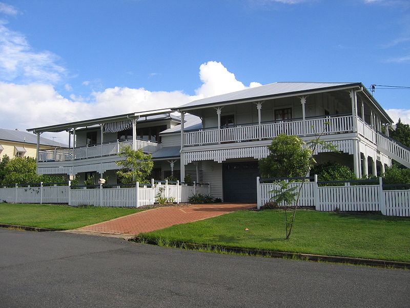
Houses in Brisbane. Image: Wade Johanson
1,400
Let’s get sparser still.
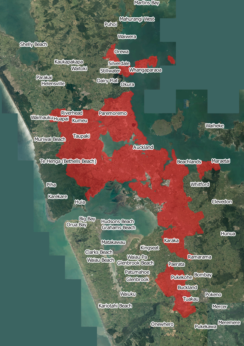
Now we’ve filled the Upper Harbour, spread west to Waimauku, and into the lifestyle blocks of the Waitakere ranges as far as the regional park boundary. South, we’ve got to about Runciman, halfway to Pukekohe, and Pukekohe itself has spread out a few kilometres. This is also about the density you’d find in:
- Salt Lake City, Utah, United States
- Christchurch
- Palmerston North
- Dunedin
Or within real-world Auckland:
- Red Hill, Papakura
- Hatfields Beach, north of Orewa
House in Salt Lake City. Image: Wikipedia user NoeHill
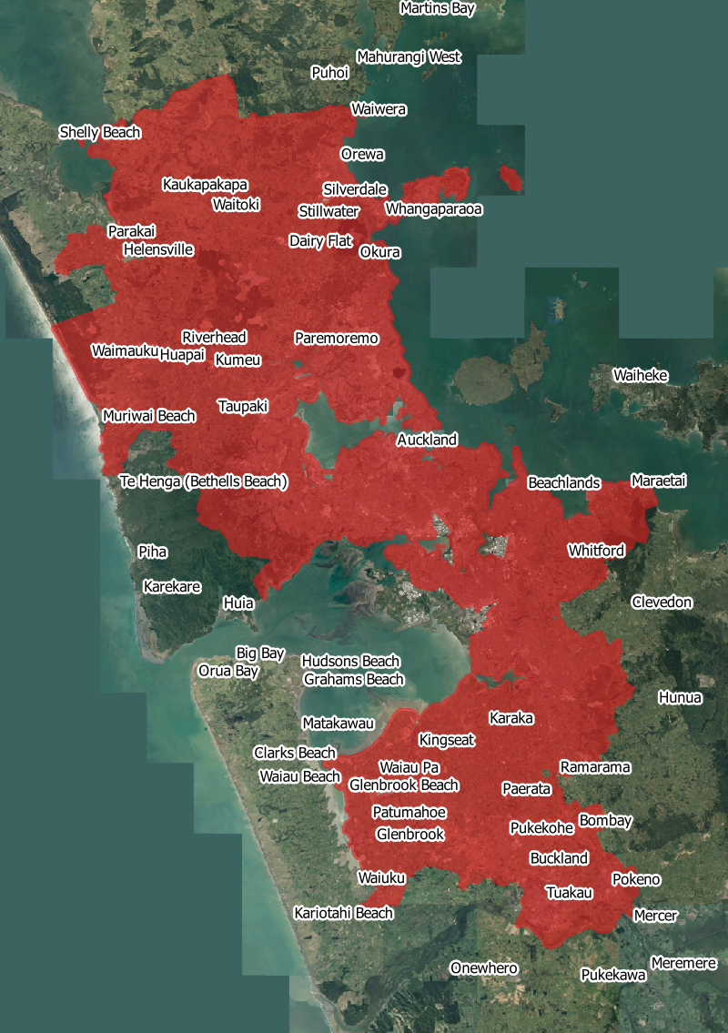
1,150
Let’s get sparser again. Houston is often mentioned by advocates of outward expansion, so what would we look like at a Houstonian 1150 people per square kilometre?
We’ve now filled in Dairy Flat, the lifestyle blocks out as far as Maraetai, and Drury. This is about the density of
- Houston (as mentioned)
- Tauranga
- Rotorua
- Levin
Or within present-day Auckland:
- Greenhithe
- Tuakau5
- Waiuku
House in Houston. Image: Pixabay
650
How sparse can we go? Let’s take it to the limit. The world’s sparsest city of a size comparable to Auckland is Charlotte, North Carolina, USA. It’s a mere 650 people per square kilometre.
To be this sparse, Auckland would spread to the shores of the Kaipara and through the whole inland area between there and Waiwera. Aside from the (hopefully still protected) Waitakere Ranges, it would spread west to the Tasman sea. It would go southwest to not just Pukekohe but Waiuku and Pokeno.
There are no other large cities as sparse as this. Within New Zealand, this is similar to:
- Stratford
- Marton
- Te Kuiti
All towns of just a few thousand people. Within Auckland, the only area as sparse as this without being completely rural6 is the further reaches of Titirangi.
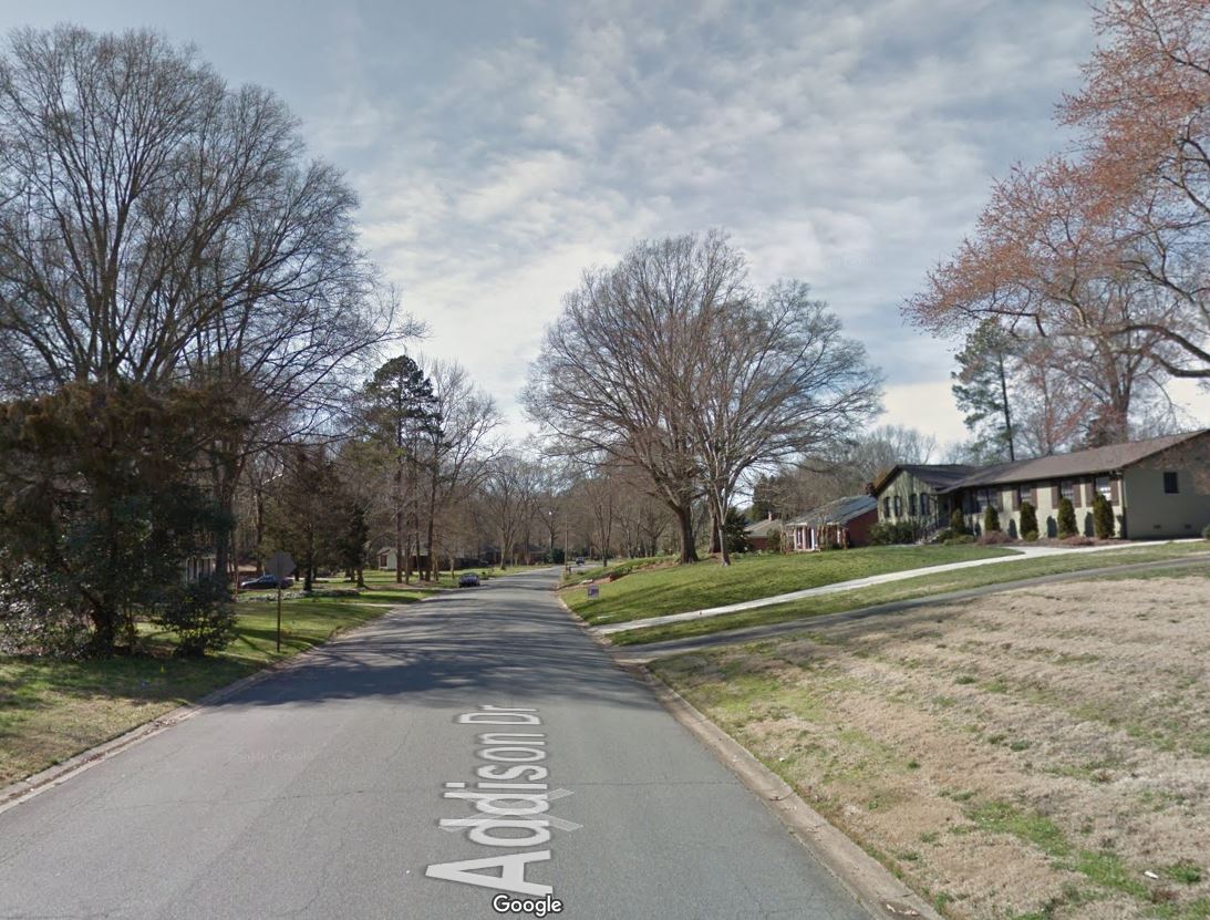
Street in Charlotte. Image: Google Maps
What about denser?
That’s as sparse as we go. It’s probably also time for a breather. Next time, we’ll see what Auckland would look like if it were not sparser, but denser than it is now. We’ll see Auckland as it would look if it had been built like some famous cities around the world.
Notes
-
Tuesday, 5 March 2013 to be precise: census night. Almost all data is from Stats NZ. Place names are from Peter Scott, aerial imagery is from LINZ. ↩
-
Strictly speaking, this definition applies to urban areas divided into a regular grid of 1km squares. I’m going to use census area units, because it’s what I have available. They aren’t square, but they are about the same size. ↩
-
Generally, for the “urban area” of that city, rather than following political boundaries. These figures are not necessarily comparable to the figures I’ve come up with for Auckland, but they are in the same ballpark, and it’s what we’ve got to go on. In particular, this will be important for densities much greater than present-day Auckland, which we’ll see in part 2. ↩
-
I’ve made some fairly arbitrary choices about where we would have sprawled to: generally I’ve avoided hills, already industrial areas and already existing rural towns. Again, this is just to get an idea. ↩
-
Not technically part of Auckland Council, but part of what Statistics NZ considers the greater Pukekohe area. ↩
-
That is, still over our 300 people per square kilometre threshold to count as urban. ↩